


Here's a detailed guide to the 6 most beautiful hiking routes along the Costa Blanca and Costa Cálida in Spain.
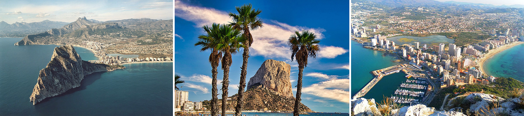
Coordinates: 38.646° N, 0.046° E
1. Peñón de Ifach – Calpe (Costa Blanca)
Description: An iconic limestone outcrop rising 332 meters above the Mediterranean, offering panoramic coastal views.
Distance: ~5 km (round trip)
Duration: 2–3 hours
Difficulty: Moderate to Hard
Why it's special:
This iconic limestone rock rises dramatically from the sea and is visible from miles around. The trail winds through a natural park rich in flora and fauna, leading to a summit with panoramic views of the coast.
History & Tips:
- Once used as a watchtower against pirates in medieval times.
- The first part is a gentle walk, but after the tunnel (bring a flashlight or headlamp), it gets steeper and more technical.
- Go early in the morning or off-season to avoid crowds and heat.

Coordinates: 38.7500° N, 0.1833° E
2. Barranco del Infierno – Vall de Laguar (Costa Blanca)
Description: Known as the “Cathedral of Hiking,” this route features over 6,500 stone steps through dramatic ravines.
Distance: ~14 km loop
Duration: 5–6 hours
Difficulty: Moderate to Hard
Why it's special:
Nicknamed the "Cathedral of Hiking," this route includes over 6,500 stone steps built centuries ago by the Moors. You’ll pass through steep ravines, abandoned terraces, and almond groves.
History & Tips:
- Part of ancient Moorish irrigation and agricultural systems.
- Spring and autumn are ideal; it can be very hot in summer.
- Bring plenty of water and snacks – there are no services along the route.

Coordinates: 38.6616° N, 0.0473° W
3. Sierra de Bernia – Altea/Benissa (Costa Blanca)
Description: A circular trail with stunning views, including the Forat de Bernia, a natural tunnel through the mountain.
Distance: ~9 km (circular)
Duration: 4–5 hours
Difficulty: Moderate
Why it's special:
A wild, rugged mountain ridge with breathtaking views of the sea and inland valleys. The hike includes the famous Forat de Bernia, a natural tunnel through the mountain offering postcard-perfect views.
History & Tips:
- Features ruins of a 16th-century fortress (Fort de Bernia), built to prevent internal revolts.
- You’ll need to scramble a bit near the tunnel – headlamps help.
- Great spot for photography, especially during golden hour.

Coordinates: 37.5510° N, 1.1210° W
4. La Ruta de los Acantilados – Cabo Tiñoso (Costa Cálida)
Description: A coastal path along dramatic cliffs, featuring abandoned military installations and secluded coves.
Distance: ~7 km (one way)
Duration: 3–4 hours
Difficulty: Moderate
Why it's special:
A remote trail along dramatic cliffs overlooking the Mediterranean. You’ll see abandoned gun batteries, secret coves, and likely some wild goats.
History & Tips:
- Home to several Civil War-era bunkers and artillery emplacements.
- Bring binoculars – it's a birdwatcher's paradise.
- No shade or water sources, so prepare accordingly.
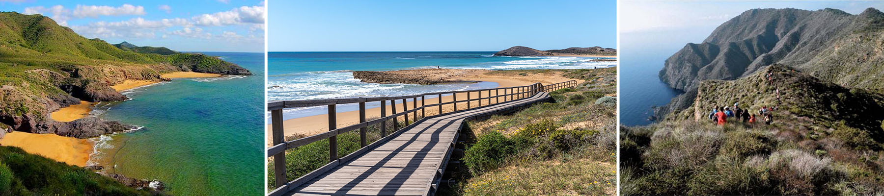
Coordinates: 37.6020° N, 0.7580° W
5. Parque Regional de Calblanque – Near Cartagena (Costa Cálida)
Description: A protected area with diverse landscapes, including beaches, dunes, and salt flats.
Distance: Variable trails, 3–12 km
Duration: 1–4 hours depending on the route
Difficulty: Easy to Moderate
Why it's special:
A protected coastal area of dunes, salt flats, and pristine beaches. Gentle hills lead to gorgeous viewpoints and unspoiled natural beauty.
History & Tips:
- No major development here – it’s one of the best-preserved coastal ecosystems in Spain.
- Perfect for a mix of beach and hike.
- In summer, access by car is limited – shuttles run instead.
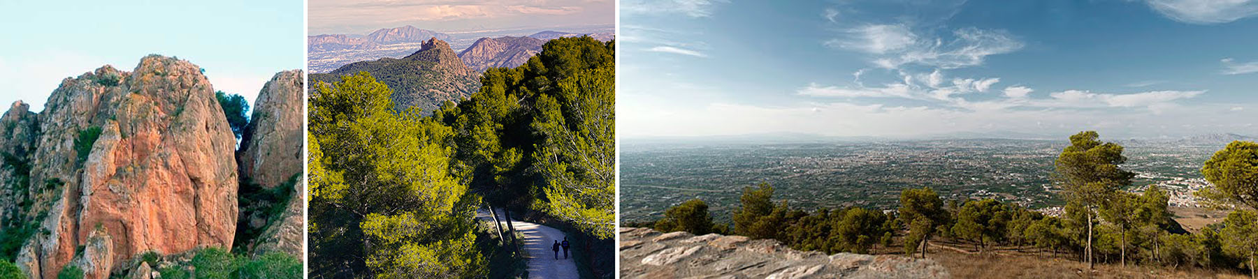
Coordinates: 37.9401° N, 1.0849° W
6. Cresta del Gallo – Murcia (Costa Cálida Inland)
Description: A scenic ridge offering panoramic views of the Huerta Murciana and surrounding mountains.
Distance: ~10 km (loop)
Duration: 3–4 hours
Difficulty: Moderate
Why it's special:
Located just outside the city of Murcia, this route winds through pine forests and along ridges with dramatic views of the Huerta Murciana (Murcian orchard plains).
History & Tips:
- Popular with local climbers and hikers – it has a vibrant outdoors scene.
- Ideal for sunrise hikes.
- Combine with a visit to the nearby Santuario de la Fuensanta, a picturesque Baroque monastery.
Final Tips for All Hikes:
- Always check weather and trail conditions before you go.
- Wear proper footwear – some trails have rocky, uneven terrain.
- Many routes have limited shade – bring sun protection and plenty of water.
- Respect local wildlife and pack out all trash.


